- HOME
- X-PLANE
- LINKS
- Mein Cockpit
- OBJEKTE
- SZENERIEN
- Szenerien-Liste
- Szenerien - Karte
- Modellflugplätze
- HELI - Landeplätze
- 4077 M.A.S.H.
- AAT Ranshofen
- EI01 Fastnet Rock
- F1 Spielberg Racetrack Heliport
- KH Dornbirn
- KH Linz
- KH Rudolfstiftung Wien
- KH Weisser Hof
- LKH-Hainburg
- LKH Hartberg
- LKH Rottenmann
- LKH Schladming
- LKH Wagna
- LOAC KH Kittsee
- LOAE KH Eisenstadt
- LOAF KH Baden
- LOAH KH Horn
- LOAI LKH Wr. Neustadt
- LOAJ Aspern Öamtc
- LOAK KH Krems
- LOAL Pöchlarn-Wörth
- LOAM Wien Meidling
- LOAO KH Oberpullendorf
- LOAY Kilb Heliport
- LOAZ KH Zwettl
- LOBA AKH Wien
- LOBI KH Mödling
- LODL Business Center Leitner
- LODO Oberwart OEAMTC
- LOGR KH Oberwart
- LOIB Hörlahof
- LOIC St. Anton a. Arlberg
- LOID KH Kufstein
- LOIE BKH Reutte
- LOIF LKH Feldkirch
- LOIG Wucher Ludesch
- LOIL Zams Christophorus 5
- LOIM Heliport Kufstein
- LOIO Sölden
- LOIP Ischgl Idalpe
- LOIU LKH Innsbruch HeliPort
- LOIW Waidring
- LOJC Christophorus 4 Reith
- LOJI Medalp Imst
- LOJK Kaltenbach
- LOJN Christophorus 8 Nenzing
- LOJP Karres
- LOJT Hintertux
- LOJW Wucher Gallus 1 Lech/Zuers
- LOLY ÖAMTC Christophorus 15 Ybbsitz
- LOGA LKH Bad Radkersburg
- LOJH Martin 8 Hochgurgl
- LOMP Patergassen
- LOPK LH Phyrn-Eisenwurzen Kirchdorf
- LOMW LKH Wolfsberg
- LOSJ St. Johann im Pongau
- LOWH Hanusch Krankenhaus
- Tauernklinikum Zell am See
- LOXH Hochfilzen
- LOXS Schwarzenbergkaserne
- UKH Lorenz Böhler
- UKH Meidling
- AT02 Scalaria airchallenge
- LAA-Ungerndorf
- LEGO Mistelbach
- LOAA Ottenschlag
- LOAB Dobersberg
- LOAD Völtendorf
- LOAG / LOBK Krems-Langenlois
- LOAN / LOAW Wr. Neustadt Ost
- LOAR Altlichtenwarth
- LOAS Spitzerberg
- LOAT Trausdorf
- LOAU Stockerau
- LOAV Vöslau
- LOGF Fürstenfeld
- LOGG Punitz
- LOGI Trieben
- LOGK Kapfenberg
- LOGL Lanzen-Turnau
- LOGM Mariazell
- LOGO Niederöblarn
- LOGP Pinkafeld
- LOGT Leoben Timmersdorf
- LOGW Unterfladnitz
- LOIH Hohenems
- LOIJ St. Johann
- LOIK Kufstein
- LOIR Reutte Höfen
- LOKF Feldkirchen
- LOKG Glainach
- LOKH Friesach
- LOKL Lienz / Nikolsdorf
- LOKM Mayerhofen
- LOKN Nötsch
- LOKR Sankt Donat
- LOKW Wolfsberg
- LOLC Scharnstein
- LOLE Eferding
- LOLF Freistadt
- LOLG Sankt Georgen
- LOLH HB-Hofkirchen
- LOLK Ried Kirchheim
- LOLO Linz Ost
- LOLS / LOLD Schärding-Suben
- LOLM Micheldorf
- LOLT Seitenstetten
- LOLU Gmunden
- LOLW Wels
- Windparks Österreich
- LOIQ Schenkair Feldkirch
- LOSM Mauterndorf
- LOWF Fischamend
- LOWG Graz Thalerhof
- LOWI Innsbruck Kranebitten
- LOWK/LOMU Klagenfurt
- LOWL Blue Danube Airport Linz
- LOWS W.A.Mozart
- LOWW Wien Schwechat
- LOWZ Zell am See
- LOXA Aigen
- LOXN Wr. Neustadt West
- LOXT Tulln
- LOXZ Zeltweg
- Leopoldsdorf im Marchfeld
- Aircrafts
- OE-HANGAR
- Tips und Tricks
- Addons für Österreich
- Allgemeines zur X-Plane Welt
- Europäische Strassen
- Kalkulation Light-Spill
- LUA-Scripts
- Modifikation von X-Plane mit JSGME
- PCL (Pilot controlled lights)
- Weniger Schnee auf der Runway
- Europäische Autobahn Beleuchtung
- Flugzeug-Bemalungen (Liveries) anpassen
- Tutorials
- Wir bauen eine Szenerie I
- Wir bauen eine Szenerie II
- Objekte für X-Plane I
- Objekte für X-Plane II
- Objekte für X-Plane III
- Objekte für X-Plane IV
- Objekte für X-Plane V
- Objekte für X-Plane VI
- Animationen bei Objekten
- Objekte in X-Plane positionieren (WED)
- Die Anwendung von Fassaden (.fac)
- Helipads als Markierung
- Rollmarkierungen
- Strassen mit Verkehr selbst erstellen
- Wir bauen eine Linie (.lin)
- Wir bauen einen Wald (.for)
- Wir bauen uns Bäume (.obj)
- Work in progress
- LIVERIES
- A319-100 OE-LDG
- A320-232 (Paul Glanville)
- A320-232 (QPAC)
- A321 (riviere) Austrian OE-LBF
- AS 350 B3+
- Airbus A330-200 (JAR-Design)
- Aquila A210 (Picus-X)
- BK117 (NDArt)
- Boeing 737-300 (IXEG)
- Boeing 737-8 ZIBO
- Boeing 737-800 (EADT)
- Boeing 747-8i Adv. (SSG)
- Boeing 757-200PW+RR (FF)
- Boeing 757-300RR (Flight Factor)
- Boeing 767 (Flight Factor)
- Boeing 777-200ER (Ramzzess)
- Boeing 787
- C172SP
- CRJ-200 (JROLLON)
- CRJ200
- Dash 8 Q400
- Diamond Aircrafts
- E-190 (SSG)
- EC-135V3 (Rotorsim.de)
- MD80 (Rotate)
- MD902 (Dawson Designs)
- Pilatus PC6
- RJ100
- Vickers Viscount
- Missionen / Flugpläne
LOAT Trausdorf
Verfasst von oe3gsu am Fr, 2018-11-09 15:29
State today:
Since the airport buildings were never bombed (the airfield itself has already been hit), many of the typical buildings in the distinctive Nazi architecture are still preserved. Only the wooden barracks have completely disappeared except for a foundation.
First plans
In 1913, the Eisenstadters were lured into the street by a peculiar noise. At an altitude of 500 meters, one noticed an airplane, which flew towards military upper secondary school and then drove to Trauersdorf, where he settled on the pasture. In 1925 it was discussed to build for the young state capital in the vicinity of the Eisenstadt station in the direction of Trausdorf a Linienflughaften. But this plan was never realized.
In war
It was only in 1936 that the Trauersdorfer airfield was founded on the initiative of the Federal Army. In 1938, the German Air Force took over the airfield. Until 1945, the airfield served war purposes. Fortunately, Trausdorf was spared aerial warfare throughout the war.
Peaceful use
1955, after deduction of the occupying power, there was no air traffic. 40 hectares of the airfield area were leased and used for agriculture. The Union Sportflieger Club, founded in 1950, began operations and began operations in 1957. Approved was an airfield for powered aircraft up to 2000 kilograms and gliders. There were two runways in north-south and east-west directions with a length of 1100 meters and 800 meters, respectively.
A leasing contract from 1963 regulated the release of parts of the pasture to the Sportflieger Club: The Urbarialgemeinde leased about 80 hectares, the political community about 10.5 hectares. The lease was concluded for a period of 20 years.
Noise pollution is increasing
In the early 1970s, a firing system was built to enable night sightseeing flights. Three hangars were built. The flight operations became more and more extended and caused more and more noise. In 1974, the political community of Trausdorf complained to the state government about the aircraft noise for the first time. In 1973, there were already 35,000 launches and landings of powered aircraft. The construction of a paved runway was rejected by Trausdorfer page strictly. In 1977, the state government approved the construction of a tower.
The Urbarialgemeinde and the political community decided, after expiration of the lease in 1983, this no longer extend. This decision was not taken note of by the Union Sportflieger Club. There followed a years-long lawsuit. Only in 1994, the club stopped its flight activities completely.
1.The Original
This report was only possible through the generous help of the former base commander. Thank you very much!
Location:
South of Eisenstadt

©Schmitzberger
Reconstruction of the original condition
History:
In 1938, construction work on an airfield started south of Trausdorf. The following buildings were built:
1 main building (flat for groundskeeper and two apartments for officers)
1 large farm building
Several small outbuildings
2 bunny stables (angora hare fur was used for parachute production)
1 economic barrack
1 washhouse
1 barrack for the flight line
4 accommodation huts (1/2 accommodation - 1/2 classroom)
2 hangars (different sizes)
In order to make aircraft landings possible on the extensive wetland, extensive drainage had to be carried out.
1939 - Stationing of the "B-training" of the Fliegerschule Bad Vöslau
April 1943 - departure of the aviation school. For about four weeks deployment of the Jagdgeschwader Mölders and Udet
May 1943 - Outside area of the air base Wiener Neustadt, which was completely overcrowded at that time. Thus, according to Trausdorf, e.g. some Ju 52 relocated.
1945 - Use of the airfield by the Red Army
1955 - civil airfield
In recent years, air traffic has been increasingly restricted and finally stopped altogether.
Today: Model airfield and parking for sailing yachts. Rare helicopter landings of the Austrian Armed Forces.
Former airfield dimensions:
In north-south direction: 600 meters
In east-west direction: 860 meters
The flight school:
In Trausdorf four groups with 48 students each were stationed. With trainers and other staff that resulted in a total of 260 people. Each group was joined by a group instructor and six to seven flight instructors. The training required a large number of aircraft. In Trausdorf 100 to a maximum of 112 aircraft of the following types were stationed:
He 72 cadet
Klemm
Arado
Bü 131
Bü 133
The student pilots completed the first 60 flights accompanied by a teacher. This was followed by independent flights, during which they had to circle the church towers of Trausdorf and Siegendorf. It was around the clock aircraft noise, since the night flight training took place here. Later in the training the practice flights became more and more extended and led to Markersdorf or Brno. A major disadvantage of the location Trausdorf were the frequent storm warnings that hindered the operation of the aircraft.
State today:
Since the airport buildings were never bombed (the airfield itself has already been hit), many of the typical buildings in the distinctive Nazi architecture are still preserved. Only the wooden barracks have completely disappeared except for a foundation.

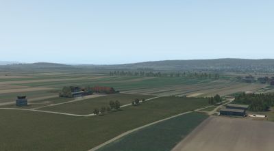
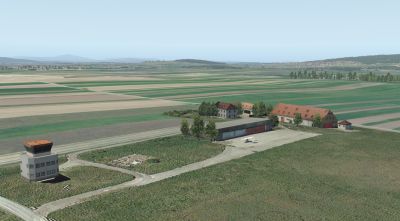
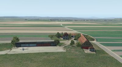
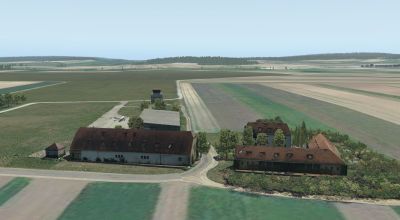
The residential building and the large farm building are still recognizable today (right picture border). Hangar and Tower are postwar buildings. The original hangars were in place of the windsock. The foundation of the smaller hangar is still preserved (left half of the picture).

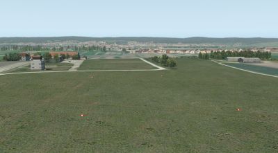
To the picture: Overall view of the terrain. The tower and all hangars were created after the Second World War. On the right side of the picture is the municipality Trausdorf, in the background Eisenstadt and the Leitha Mountains. In the foreground the "Hutweide", the former airfield. At the site where there are two hangars today (right of the center of the picture), there were once the student students' barracks (possibly the foundations are identical).
(Source: http://www.geheimprojekte.at/flugplatz_trausdorf.html)
1913 to 1994
On a part of the pasture was until 1994 the Trausdorfer airfield. Even today, the distinctive tower and a few other buildings remind of the air traffic. After a twelve-year legal dispute, the competent authorities withdrew all permits from the sports flying club based in Trausdorf. The airfield came to supraregional renown on the occasion of the Pope's visit in 1988, when around 100,000 worshipers gathered on the expansive lawns to celebrate the Holy Mass together with John Paul II.
From the chronicle of the airfield (Source: Brochure on the occasion of 140 years Urbarialgemeinschaft - community Trausdorf, published in 2004):
First plans
In 1913, the Eisenstadters were lured into the street by a peculiar noise. At an altitude of 500 meters, one noticed an airplane, which flew towards military upper secondary school and then drove to Trauersdorf, where he settled on the pasture. In 1925 it was discussed to build for the young state capital in the vicinity of the Eisenstadt station in the direction of Trausdorf a Linienflughaften. But this plan was never realized.
In war
It was only in 1936 that the Trauersdorfer airfield was founded on the initiative of the Federal Army. In 1938, the German Air Force took over the airfield. Until 1945, the airfield served war purposes. Fortunately, Trausdorf was spared aerial warfare throughout the war.
Peaceful use
1955, after deduction of the occupying power, there was no air traffic. 40 hectares of the airfield area were leased and used for agriculture. The Union Sportflieger Club, founded in 1950, began operations and began operations in 1957. Approved was an airfield for powered aircraft up to 2000 kilograms and gliders. There were two runways in north-south and east-west directions with a length of 1100 meters and 800 meters, respectively.
A leasing contract from 1963 regulated the release of parts of the pasture to the Sportflieger Club: The Urbarialgemeinde leased about 80 hectares, the political community about 10.5 hectares. The lease was concluded for a period of 20 years.
Noise pollution is increasing
In the early 1970s, a firing system was built to enable night sightseeing flights. Three hangars were built. The flight operations became more and more extended and caused more and more noise. In 1974, the political community of Trausdorf complained to the state government about the aircraft noise for the first time. In 1973, there were already 35,000 launches and landings of powered aircraft. The construction of a paved runway was rejected by Trausdorfer page strictly. In 1977, the state government approved the construction of a tower.
The Urbarialgemeinde and the political community decided, after expiration of the lease in 1983, this no longer extend. This decision was not taken note of by the Union Sportflieger Club. There followed a years-long lawsuit. Only in 1994, the club stopped its flight activities completely.
(Source: http://www.trausdorf-wulka.gv.at/index.php/tourismus.html)
2.The scenery
The scenery is based on publicly available information and photos created in September 2018 on site.
All objects have been new created.
Charts
not available
3.Functions (summary)
- Photorealistic buildings at the Airport and the neighborhood
- Compatibel to X-Europe V2.0 from PliotBalu
- Groundtexture
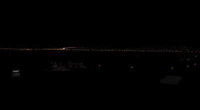
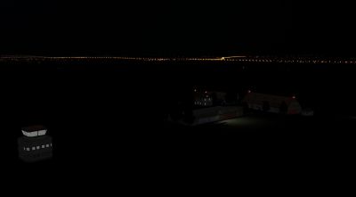
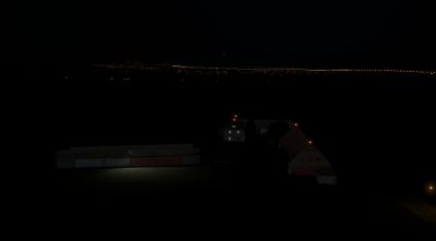
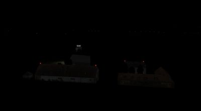
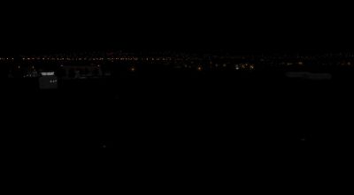
- realistic lighting and night-textures
4.Installation
Just copy the folder " LOAT Trausdorf 2.0" in the compressed file after unpacking in the "Custom Scenery" - folder.
directory structure:
<X-Plane-Folder>/
Custom Scenery /
LOAT Trausdorf 2.0/
Earth nav data and others)
and restart X-Plane.
5.Recommended settings
To visualize all light effects, HDR should be activated. The higher the settings for "texture resolution" and "airport detail" the better the quality of the scenery but the more affect on the FPS ratio.
6.Required Software
X-Plane® Version 11.11+
7.Used Libraries
none
8.Recommended addons
Although the scenery will work without any addons, we recommend to use the following ones for the whole experience (pictures taken with addons installed):
simheaven_X-Europe-1, -2, -3 by PilotBalu,
Download von: http://simheaven.com/simdownloads/x-europe/
9.Credits
LAMINAR RESEARCH® X-Plane®
Ben Supnik WED (Version 1.6.1 verwendet)
marginal Sketchup-Plugin
If you like this Scenery, we appreciate your donation:
 |
 |
 |
 |
 |
 |
 |
 |
 |
 |


